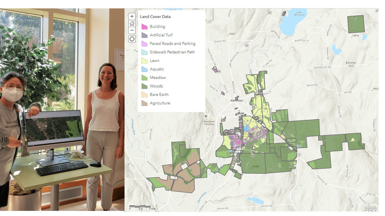
L: Myongsun Kong, Geography Department Research and Teaching Support Technician with Sophie Schadler '23 displaying the map at the Summer 2022 Undergraduate Research Symposium. R: Image of map containing some of Colgate’s property within the Town of Hamilton, color coded by land cover type.
How best can Colgate manage its property?
This important question requires some basic information; how much does Colgate own and what is that land being used for?
Tingkuan Hsieh '24 and Sophie Schadler '23 used a Geographic Information System (GIS) to create an updated digital map of Colgate's holdings this summer, by request of Colgate's Facilities Department (Buildings and Grounds) and under the guidance of Research and Teaching Support Technician Myongsun Kong.
The students used county tax records to determine parcel ownership and then two satellite imagery basemaps to define the extent of Colgate’s property and generate land cover data. After querying the county data, Colgate is named as the primary owner of 106 parcels of land in Madison and Franklin Counties combined. Then each parcel was divided up based on visual inspection from New York State's Web Mapping Systems (2017) and ESRI World Imagery (2021) into one land cover type from a list of ten provided; building, paved roads and parking, sidewalk pedestrian paths, lawn, meadow, woods, artificial turf, aquatic, agriculture, and bare earth.
After determination of land cover, Sophie and Tingkuan were able to calculate the area of specific land cover types. Facilities will be able use this map for a variety of tasks, such as determining the total length of road and sidewalk they need to plow or the total area of lawn they need to mow, which can potentially lead to better planning and potentially decrease fossil fuel emissions.
This work was done with support from the Hanke Fund.